Flagship Research Projects
{imageshow sl=23 sc=6 w=800 h=400 /}
NILAFAR - The NILE & AFAR areas: hydrological change sensitivity and impact on past human adaptation since 20,000 years
- Details

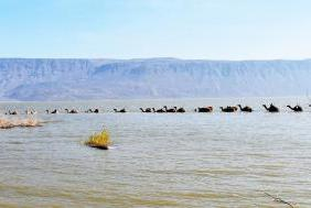
The NILAFAR program proposes to study the impact of hydrological fluctuations on societies in NE Africa over the last 20,000 years and in particular on the development of pastoralism. NILAFAR also aims to better understand the climatic mechanisms at the origin of the fluctuation intensity of the African monsoon (external forcing and internal feedbacks of the climate system), and at the origin of short hyperarid episodes. During the African Humid Period (AHP) these episodes saw the retraction or dissemination of particularly mobile human groups. In an environment that may have been as limiting as it was stimulating due to the alternance of these hyperarid and wet phases, populations innovated using new economic strategies, shifting from a predation to a production economy.
EARLI - detection of Early seismic signal using ARtificiaL Intelligence - ERC 2021
- Details
 Natural hazards such as earthquakes are difficult to predict. Dramatic developments in the field of artificial intelligence (AI), however, are paving the way for anticipating destructive events. The EU-funded EARLI project will use AI to identify weak, early seismic signals to both speed up early warning and explore the possibility of earthquake prediction. Specifically, it will implement an early-warning approach based on a newly identified signal, caused by the perturbation of the gravity field generated by an earthquake, which is ~6 orders of magnitude smaller than seismic waves (strongly limiting its detection with standard techniques), but precedes them. The second, more exploratory, objective will be to adapt the developed AI algorithm to search for even earlier signals preceding the origin of large earthquakes.
WIND - Waveform Inversion of Node Data - Consortium 2020
- Details
![]() The WIND projet aims to develop seismic imaging methods which are more specifically devoted to stationary-recording acquisitions involving sparse arrays of autonomous stations (ocean bottom seismometers or land stations). The fact that the receiver layout is fixed gives the necessary versatility to design acquisition geometries involving large source-receiver offsets and wide azimuths such that waves can interact with subsurface heterogeneities in a varied manner by trasmission, reflection and diffraction. The rich angular illumination of the subsurface resulting from these acquisition geometries provides a suitable framework for high-resolution multi-parameter imaging provided the imaging techniques manage to assimilate the information content of the seismic data. In this context, we develop the so-called Full Waveform Inversion (FWI) method that aims to reconstruct the subsurface properties with a wavelength resolution by minimizing a distance between the recorded and the simulated data.
The WIND projet aims to develop seismic imaging methods which are more specifically devoted to stationary-recording acquisitions involving sparse arrays of autonomous stations (ocean bottom seismometers or land stations). The fact that the receiver layout is fixed gives the necessary versatility to design acquisition geometries involving large source-receiver offsets and wide azimuths such that waves can interact with subsurface heterogeneities in a varied manner by trasmission, reflection and diffraction. The rich angular illumination of the subsurface resulting from these acquisition geometries provides a suitable framework for high-resolution multi-parameter imaging provided the imaging techniques manage to assimilate the information content of the seismic data. In this context, we develop the so-called Full Waveform Inversion (FWI) method that aims to reconstruct the subsurface properties with a wavelength resolution by minimizing a distance between the recorded and the simulated data.
- S5 - Synchronous Slow Slip & Seismic Swarm
- MARACAS - MARine terraces along the northern Andean Coast as a proxy for seismic hazard ASsessment - ANR JC 2018
- Com2SiCa - Understanding and Simulation of Human Behaviors in areas affected by disasters: from analysis to policy making
- FAULTS R GEMS - Properties of FAULTS, a key to Realistic Generic Earthquake Modeling and hazard Simulation
- INPOP and the Search of the Planet P9
- REMAKE - Seismic Risk in Ecuador: Mitigation, Anticipation and Knowledge of Earthquakes
- SISMED - Seismic Imaging inveStigation in MEDiterranean Sea for deep seismogenic faults
- E-POST - The Early POSTseismic Deformation
- HYDROSEIS - Role of fluids and fault HYDROmechanics on SEISmic rupture
- OBSIVA - Virtual Seismological Observatory for the Lesser Antilles Subduction
- TO-EOS - The Tohoku-Oki Earthquake from Earth to Oceans and Space
UMR Géoazur
Campus Azur du CNRS
250 rue Albert Einstein
- CS 10269 - F 06905 SOPHIA ANTIPOLIS Cedex
+33 (0)483 618 500


